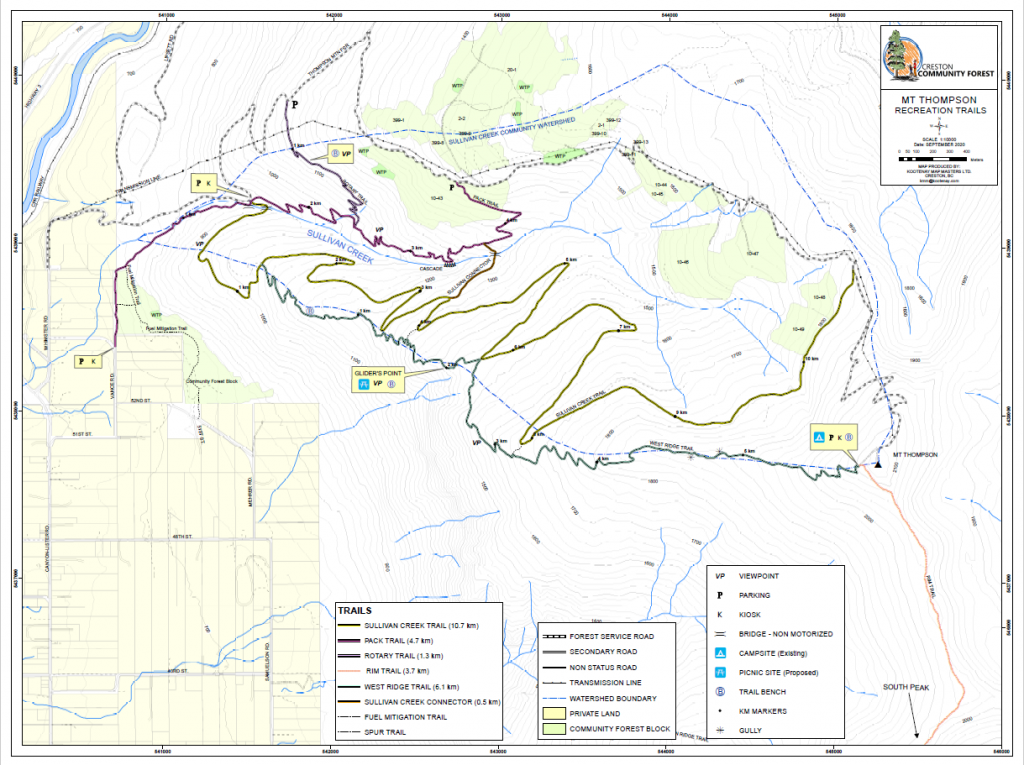
Trail Map
Quick Facts
| Distance: | 3.3km Round Trip |
| Elevation Gain: | 310m |
| Difficulty: | Moderate |
| Time: | ~1.5hrs |
| Season: | Spring-Fall |
| Parking: | Limited. Park on side of road. |
Description
This trail was created as a Creston Rotary Club project, it starts part-way up Thompson Mtn FSR, and travels through forest, and scree to a lovely viewpoint complete with a sturdy yet comfortable bench.
The map and length of this trail are up to the viewpoint, as many hikers will reverse course at this point and head back do the way they came. Alternatively, hikers can follow the trail past the viewpoint for a few hundred meters until they reach the forestry road, and can descend down to their vehicles on the road.
This trail is managed by Creston Community Forest. Their description of this trail can be found at http://crestoncommunityforest.com/thompson-rotary-trail/.
Elevation Profile

Photo Gallery