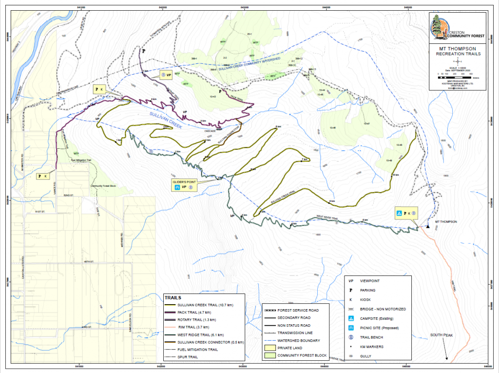
Trail Map
Quick Facts
| Distance: | 7.4km Round Trip |
| Elevation Gain: | 150m (rolling trail) |
| Difficulty: | Moderate |
| Time: | ~5hrs |
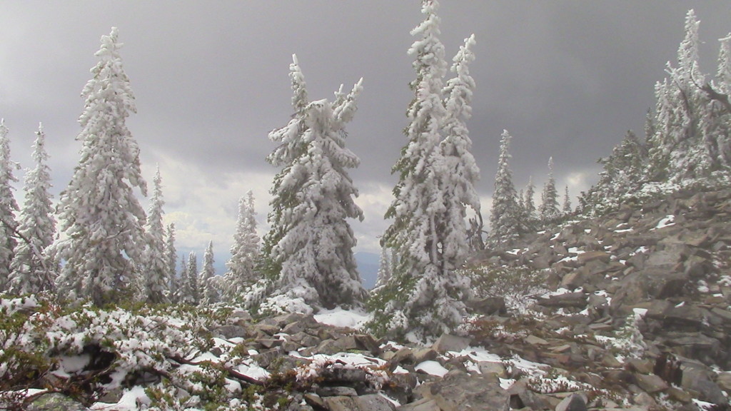
| Season: | Summer |
| Parking: | Lots |
Description
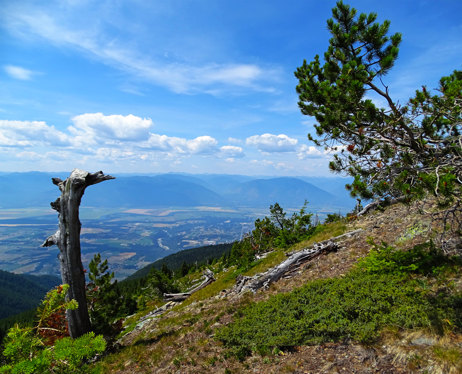
The Mt. Thompson Rim Trail is the Creston Valley’s most iconic hike. Its common knowledge that most trails offering epic views involve hiking up a mountain. This one breaks the mold by allowing the hikers to do most of the hard work in their 4x4s.
To get to the trailhead, take your vehicle head eastwards out of Creston on Hwy 3 and turn south (right) onto Canyon-Lister Rd. Go 1.1 km, turn east (left) on Whimster Rd, go 750 m and continue on Mt Thompson Forestry Rd (gravel, steep grades) for 12 km. Upon arriving at the top of Mt. Thompson you will likely experience mixed feelings, as while the view is stunning, it’s hard to ignore the cellphone and radio towers. Don’t let them get you down, as they’ll be quickly out of view. Head past them to the trailhead which descends quickly down and along the ridge into some truly unreal sections of trail.
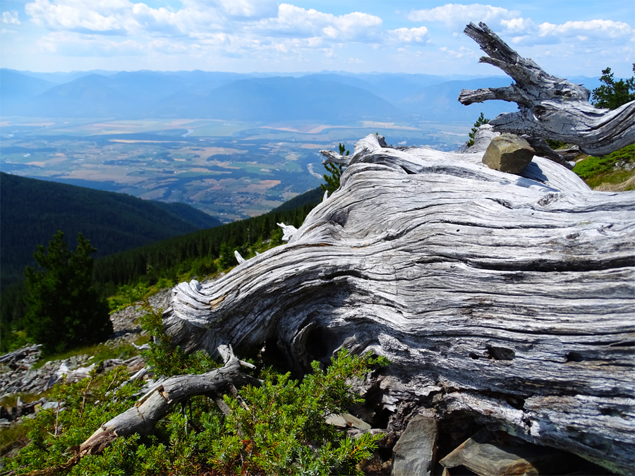
Views are expansive on both sides, stretching from the southern tip of Kootenay Lake to the north, and well past the US border to the south. Its as close to an aerial view of the Creston Valley as you can find without knowing a pilot – and you didn’t even have to hike up a mountain. After hiking for a couple hours or so you’ll get to the trail end which is another tower. From here you can look down on the Skimmerhorn and get a totally different perspective of the bumps and cliffs along its ridgeline. Going back is no easier or harder than the first half of the hike, but its a trail where one appreciates equally impressive views going both ways so the trip back is just awesome.
There is NO WATER anywhere on this trail.
This trail is managed by Creston Community Forest. Their description of this trail can be found at http://crestoncommunityforest.com/thompson-rim-trail/.
Elevation Profile