Trail Map
Quick Facts
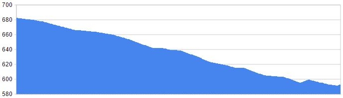
| Distance: | 750m Round Trip |
| Elevation Gain: | 100m |
| Difficulty: | Challenging |
| Time: | ~30min |
| Season: | Spring-Fall |
| Parking: | Lots |
Description
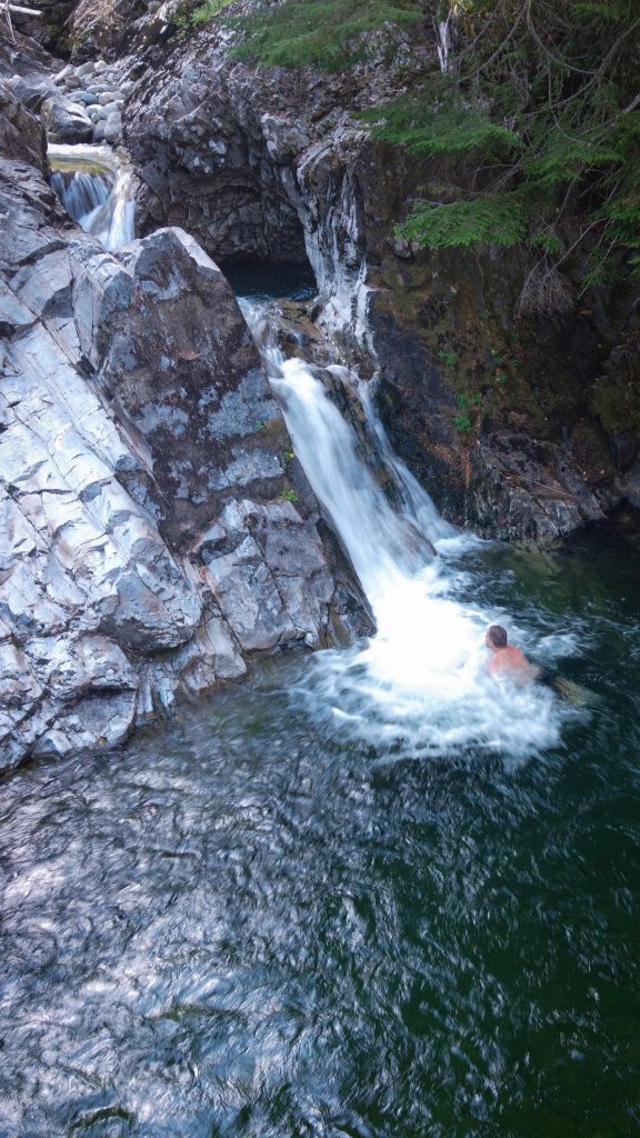
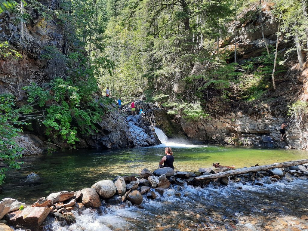
Some trails are engineered to provide the easiest possible access to their destination. Others are created haphazardly with only one thought in mind – reaching the destination as quickly as possible. This trails falls under the latter category. The trail begins at a pullout roughy 2km up Corn Creek FSR, and starts descending gently down the slope towards the sounds of the not so distant waterfall. The grade quickly steepens as hikers descend rapidly through overgrown cedars, on a trail riddled with roots and embedded rock. Within 10-15m you will be standing on the cliff above the water fall, but this isn’t the best vantage point. Down to the right you will notice a well used goat path (often equipped with a sketchy rope to aid your descent) down to a view of the waterfall that makes whole trip worthwhile. Spring hikers will be rewarded with the best views due to increased water from the snow melt.
While this is a short trail, it is highly recommended to wear boots with proper ankle support due to the grade of the hike and the obstacles on the trail.
Elevation Profile