Directions
The trailhead is well marked and found just a short distance, 150m south, from Highway 3 on West Creston Rd. There is a moderate sized parking lot on the west side of the road with space for multiple vehicles.
Description
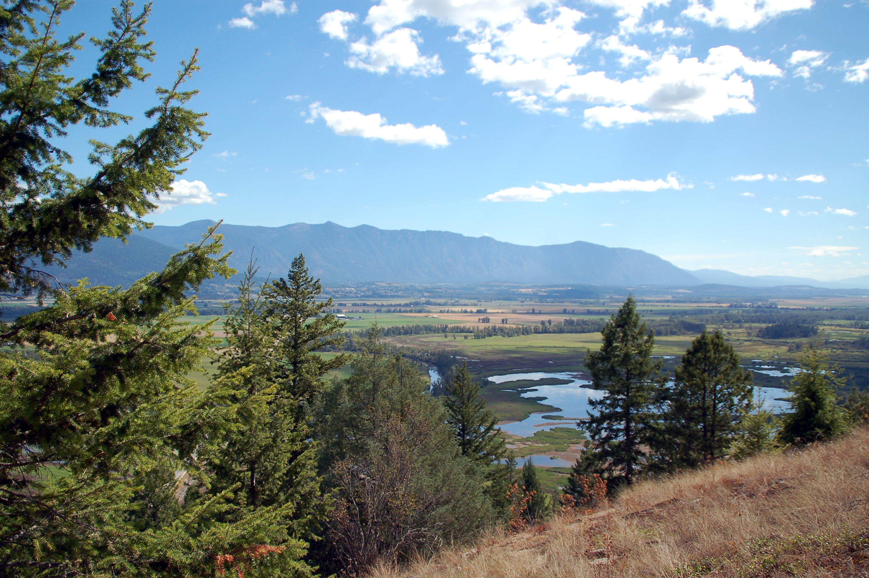
The Creston Valley’s most popular hiking trail. Getting an early start may reward you with one of the most beautiful sunrises the Valley has to offer. With expansive views of Creston and the surrounding area, this is a must-do for photographers and view-junkies.
The trail itself is in good shape, though steep at times. It winds under some powerlines to begin with but as you gain elevation parts of the trail are forested. There are excellent rest stops on the way up that allow you to sit and enjoy the view while getting your breath back. After 30min-1hr of hiking you will find yourself at the trails namesake, a huge boulder balanced oddly at the end of the trail. This is the end for many people, but the trail continues to a swampy boardwalk section where it splits in two directions. Heading up and left the trail continues up Creston Mountain. To the right the trail descends toward Summit Creek and Highway 3, making a near loop (though some highway walking will be necessary to get back to the parking lot). Bring water, especially if heading up the mountain.
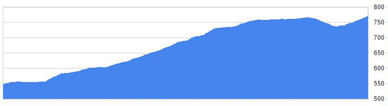
Elevation Profile
Trail Map
Quick Facts
| Distance: | 3.4km Round Trip |
| Elevation Gain: | 220m |
| Terrain: | Steep sections |
| Difficulty: | Moderate |
| Features: | Scenic Views |
| Time: | ~2hrs |
| Season: | Spring-Fall |
| Parking: | Lots |